The District of Kitimat recently released an update on the Minette Bay West Concept plan, which will potentially see further development and increased access for Kitimat residents and visitors.
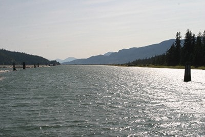
The property consists of two lots on the west side of Minette Bay, officially known as District Lot (DL) 95, which is located along the south shoreline down to the Kitimat River, and District Lot 471, which is on the north shoreline, up to Minette Bay Lodge.
According to District planner Ryan Beaudry, the District has owned District Lot 95 for over three decades. The lot was never developed for recreational use, he said, because they did not have land access to it.
“Last year, the District acquired DL 471 from Rio Tinto, who donated the land to the District to commemorate Kitimat’s 60th anniversary of incorporation. This donation opened up multiple possibilities for land access to Minette Bay West,” said Beaudry.
While no official plans to develop have been made yet by the District, the initial public reaction for the plan has been very positive.
“People are excited by the prospect of a waterfront recreational site in Kitimat and are keen to get involved in the planning process,” said Beaudry.
Phase one of the project has started, with biologists, archaeologists, landscape architects, foresters, and other professionals being “engaged to study and document the resources on the site,” according to the District. Some of the consultants are locally based, and others are from southern BC.
The group of experts will also “identify opportunities and challenges for recreation” in the area.
The Haisla Nation is also participating in the project.
To date, consultants have captured high resolution images of the 191 hectares of land using a drone, and environmental and archaeological investigations are ongoing for the rest of the summer.
Video from the drone can be found on the District's website, kitimat.ca.
The investigation work results will be shared with the public during an open house in October, with a date and location yet to be determined. A public questionnaire will also be made available at that time, both in hard copy and online.